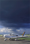
 Nearly every possible meteorological hazard a pilot may face can be present in a thunderstorm: heavy rain, high winds, hail, severe turbulence, microbursts, icing, and tornados, just to name a few. ASI just completed a weeklong educational campaign to raise awareness called Storm Week, June 9 through 16. Below is an actual scenario that highlights the possible danger of misinterpreting onboard weather.
On July 8, 2009 about 25 miles northeast of Tampa, over the Gulf of Mexico, a commercially certificated pilot with single and multi-engine land ratings, along with an instrument rating, was flying a Cessna 421C from McKinney, Texas, to Tampa, Florida, with four passengers onboard.
According to the NTSB, the pilot called Houston Flight Service to obtain a preflight briefing and file an IFR flight plan. During the briefing, “the pilot indicated he was aware of the thunderstorm activity over the Gulf of Mexico and Florida” and was willing to alter his course to avoid the weather. He was also in contact with Jacksonville Air Route Traffic Control Center (ARTCC), shortly before the accident occurred. They provided him with route weather and PIREPs for the area. According to the National Center for Atmospheric Research (NCAR), there were echoes, described as “a broken area of strong to intense cells,” indicating the presence of severe thunderstorms extending into the Gulf from Florida.
About 3 hours and 45 minutes into the flight, the pilot contacted Jacksonville ARTCC and stated he was encountering turbulence. They advised he would exit the turbulence in “about two minutes, if he continued straight ahead.” About 20 seconds after that transmission, the pilot stated that he was descending at 2,000 feet per minute and ATC asked “if he would like to turn around.” He replied that he would; however, this decision was too little action, too late. About 20 seconds after this decision, he “declared an emergency, and advised that the airplane was ‘upside down.’” Five minutes after his initial encounter with turbulence and 3 hours and 50 minutes into the flight, the pilot and his four passengers were killed upon impact with the Gulf of Mexico.
The aircraft was equipped with airborne weather radar and a lightning detector; however, both of these instruments can inadvertently lead the pilot to make a bad decision based on information that is counter-intuitive or entirely wrong. Images provided by airborne weather radar can completely misrepresent reality. This is most noticed with the phenomenon of radar shadows, which appear as an area of no precipitation behind another area of heavy precipitation. However, the area of precipitation is usually larger than shown, preventing the radar energy from penetrating it. This area of heavy precipitation masks more severe weather behind it and makes the cell that is shown appear smaller or thinner than it actually is. Pilots can be fooled into flying into the storm because it looks less intense than it really is. Lightning detectors also can lead pilots astray by misinterpreting the radio signals that lightning emits, causing range errors in the location of the lightning. This could lead a pilot to think the storm is miles away, when it is really much closer. Either one of these issues might have led the pilot to think he was safer than he actually was.
The NTSB also reported that the airplane was equipped with an XM datalink receiver. One of the drawbacks of using downloaded radar images as a tactical tool is the processing delays, as shown in the ASI Time Lapse accident case study. This 12-minute video is a must-see for all of your flying club members who fly aircraft equipped with in-cockpit datalink weather.
June 9 through 16 was the Air Safety Institute’s “Storm Week.” As thunderstorm season is here, encourage your flying club members to participate in the thunderstorm education. For your club’s next safety seminar replay the webinar presented last Thursday, June 13, by AOPA Foundation President Bruce Landsberg and air traffic controller (Boise Tower) Andy Marosvari, Thunderstorm Avoidance: ATC, Datalink, and You. It will help you understand how ATC and weather briefers can help you steer clear of thunderstorms, and when to say no to a flight. Click here to replay the webinar.
Visit the website to view the dozens of online programs and videos offered free of charge from ASI. Most are eligible for Wings credit and AOPA Accident Forgiveness. In addition, you may download certificates of completion from your ASI Transcript.
The Air Safety Institute is a division of the non-profit AOPA Foundation. Funding for ASI safety programs comes from the generosity of pilots like you.
Taylor Smith is a private pilot and student at Embry-Riddle Aeronautical University in Daytona Beach, FL, where he is studying Aerospace and Occupational Safety with a Meteorology minor. He is working at the AOPA Foundation during his summer break.